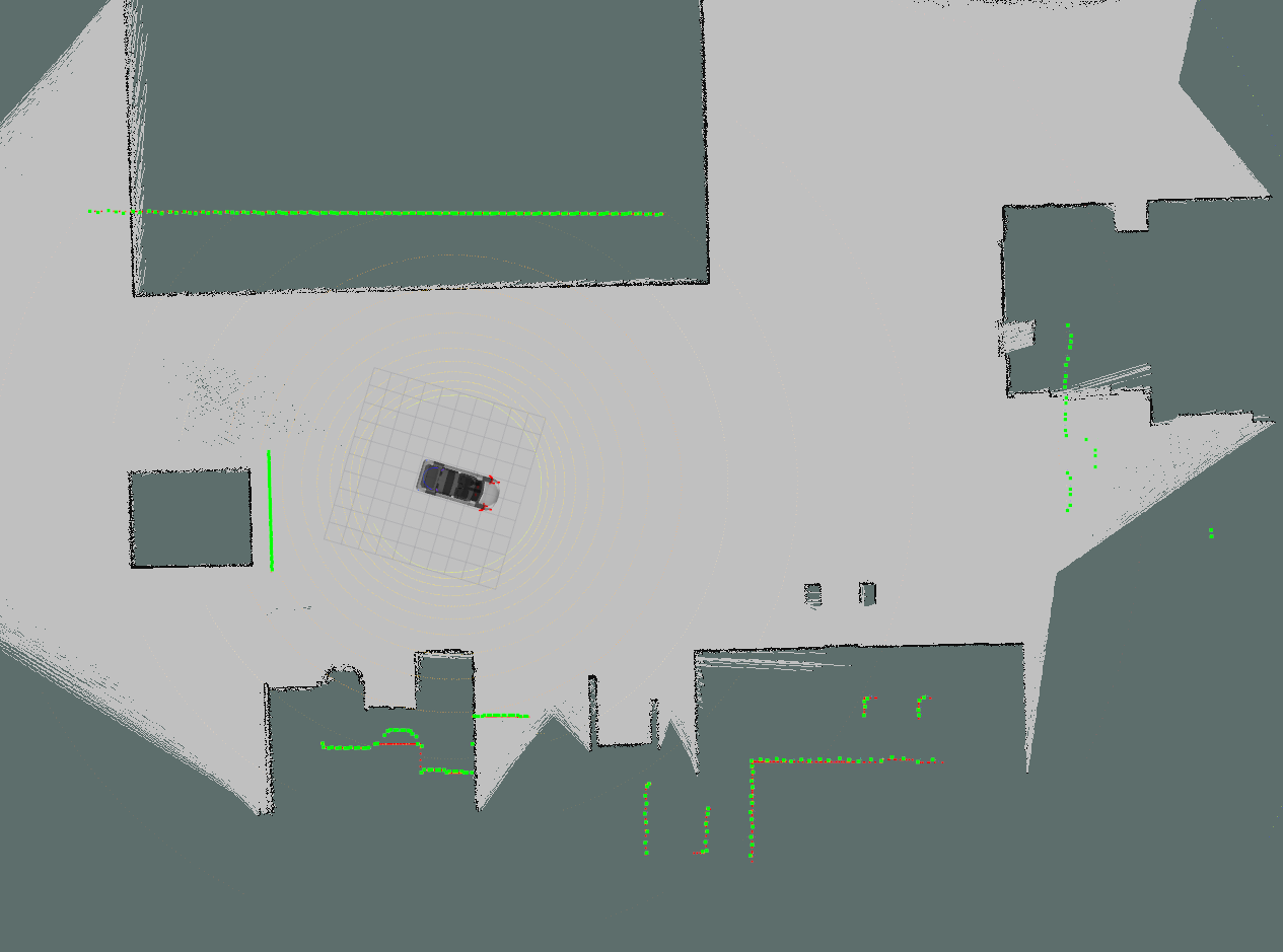
Scale Issue on Map vs Laser
Hi,
I'm working on amcl localization for my robot, and ran into this weird scaling problem between the map (made using gmapping) and the laser data.
Here's what I mean:

The laser beam in green seems "larger" than the map, in terms of size / scale. I've built the map using the same laser setup, and did not change anything incl resolution etc.
Any ideas why they don't look the same size? Am I missing something here?
Arif


That is.... interesting. Ok. How did you make / save your map to use with AMCL? Is this the same laser scanner between localization and mapping? What's the green vs the red?
I can only imagine that gmapping may have done it's best dealing with ODOM data that didn't match with the laser data and scaled the map according to ODOM.
Have you checked accuracy of ODOM and/or laser?