ROS Resources: Documentation | Support | Discussion Forum | Index | Service Status | ros @ Robotics Stack Exchange
Ask Your Question
0

Local and global costmap issues

asked 2016-04-27 09:13:12 -0600

TomSon gravatar image

Hi, I got an issue with the configuration of the local and global costmaps. I end up with this situation:
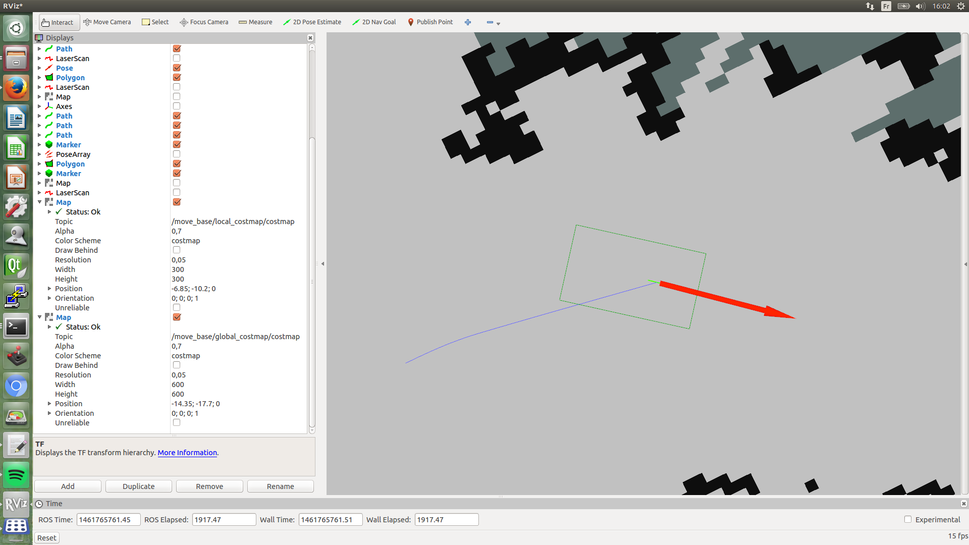
image description

For RVIZ, there is no trouble with my costmaps.

Here are my config files:

local_costmap:

local_costmap:
  update_frequency: 3.0
  publish_frequency: 3.0
  static_map: false
  rolling_window: true
  width: 15
  height: 15
  resolution: 0.05
  origin_x: 0.0
  origin_y: 0.0

global_costmap:

global_costmap: 
  update_frequency: 2.0
  publish_frequency: 2.0
  static_map: false
  rolling_window: true
  width: 40.0
  height: 40.0
  resolution: 0.05

Common_costmap:

footprint: [[-0.792, -0.344], [0.408, -0.344], [0.408, 0.344], [-0.792,0.344]]

observation_sources: scan scan2
scan: {sensor_frame: /laser, data_type: LaserScan, topic: /scan, marking: true, clearing: true}
scan2: {sensor_frame: /laser2, data_type: LaserScan, topic: /scan2, marking: true, clearing: true}

I end in this situation because I notice my global plan didn't take in count the global costmap based on the map.

edit retag flag offensive close merge delete

Comments

what situation? it is not clear what is your problem.

Procópio gravatar image Procópio  ( 2016-04-28 02:55:06 -0600 )edit

It's the same situation that this one I use 2 laserscans : one higher than the others. I have correct the situation, I will post my config files.

TomSon gravatar image TomSon  ( 2016-04-28 04:40:38 -0600 )edit

1 Answer

Sort by » oldest newest most voted
0

answered 2016-04-28 06:58:32 -0600

TomSon gravatar image

Auto-answer time :) ... or at least better configs files without troubles :)

costmap_common:

footprint: [[-0.792, -0.344], [0.408, -0.344], [0.408, 0.344], [-0.792,0.344]]

observation_sources: scan scan2
scan: {sensor_frame: /laser, data_type: LaserScan, topic: /scan, marking: true, clearing: true}
scan2: {sensor_frame: /laser2, data_type: LaserScan, topic: /scan2, marking: true, clearing: false}

inflation_radius: 0.344

global costmap:

#Independent settings for the planner's costmap
global_costmap: 
  update_frequency: 2.0
  publish_frequency: 2.0
  static_map: true
  rolling_window: map
  width: 40.0
  height: 40.0
  resolution: 0.05

local costmap:

local_costmap:
  update_frequency: 3.0
  publish_frequency: 3.0
  static_map: false
  rolling_window: true
  width: 5
  height: 5
  resolution: 0.1
  origin_x: 0.0
  origin_y: 0.0

Now the nav plan don't plan to go through map walls.

edit flag offensive delete link more

Question Tools

1 follower

Stats

Asked: 2016-04-27 09:13:12 -0600

Seen: 673 times

Last updated: Apr 28 '16